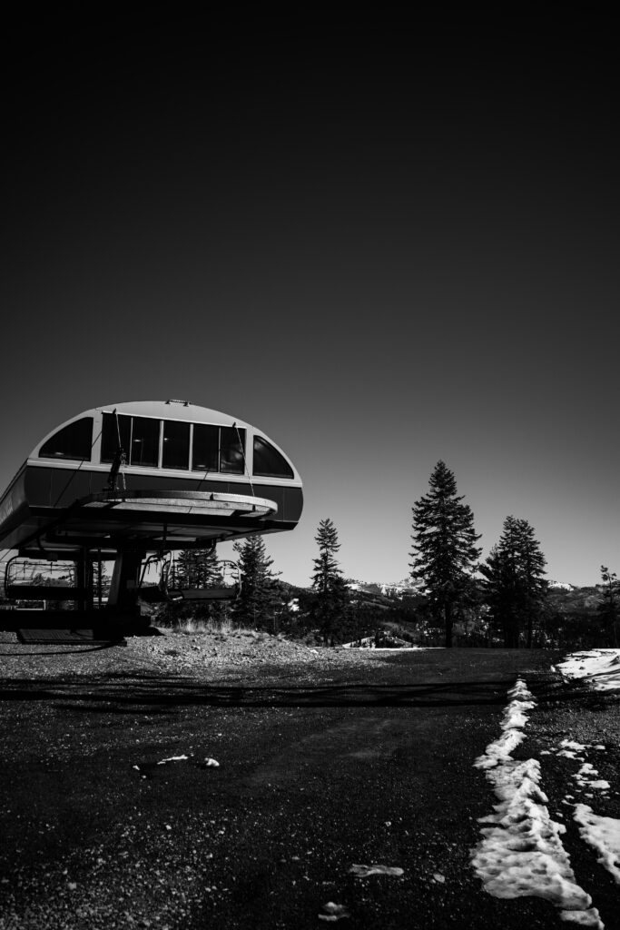
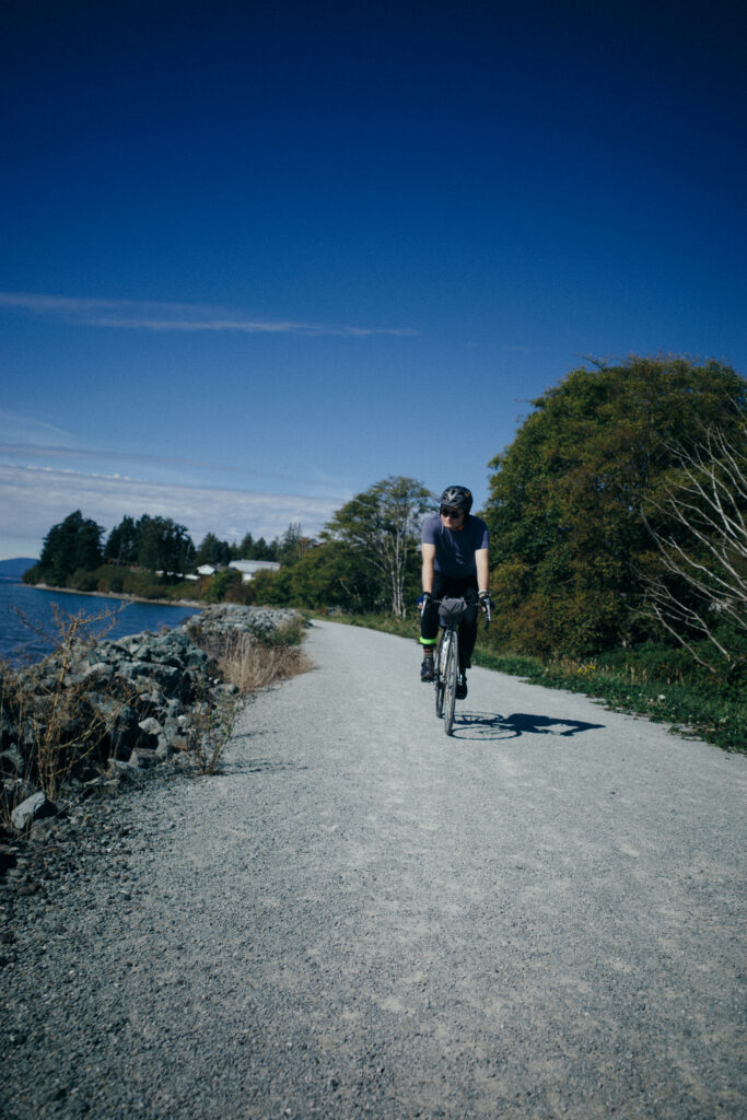
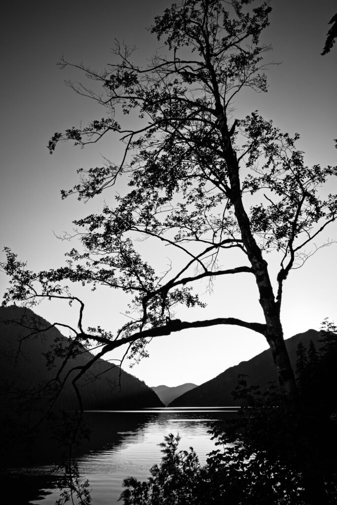
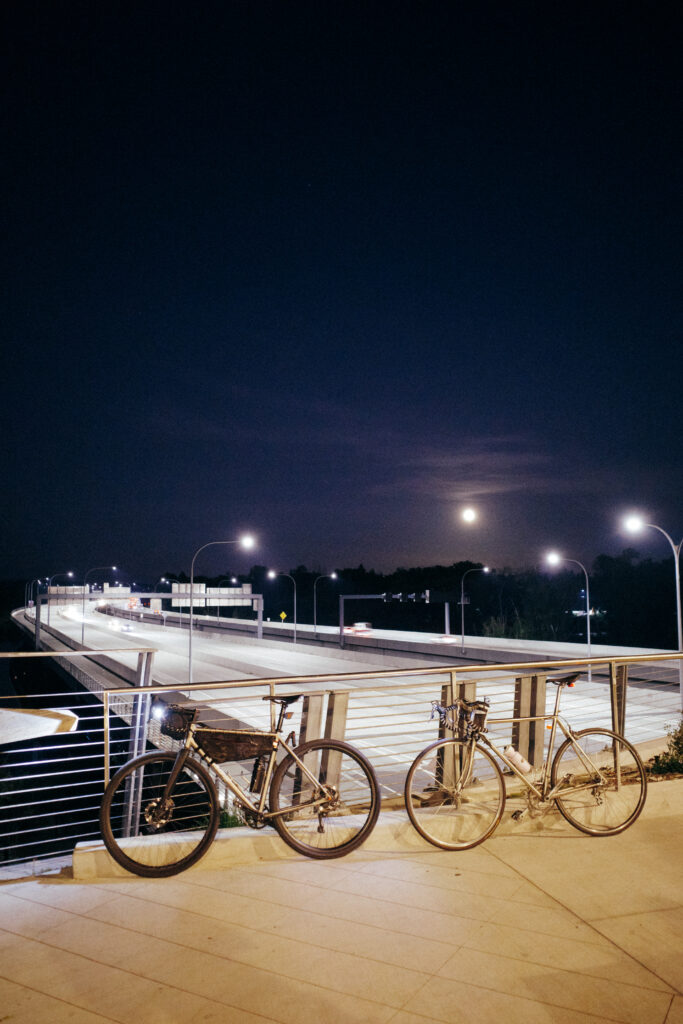
We have reached the end of 2025. After almost 1k miles since the beginning of November I’m slowly learning how to hate winter riding less. So many routes that were stunning in the summer are now muddy slogs, and even the paved trails are often covered by washouts and debris. The bike has evolved for the season as well; I’ve set up a 650b wheelset with some 2.0″ Continental racekings, the widest possible tire my frame will fit. I’ve been riding a lot more singletrack with the new wheelset, even despite the conditions.
A lot of this fall/winter’s riding has been with a local group. We meet every Wednesday night, irrespective of the weather and go on a 20-30 mile ramble on gravel or even some mountain bike paths. Some of the rides have been fantastic, and some have been wet and whiny slogs. Misery definitely loves company in this weather, and solo rides feel much harder than they should.
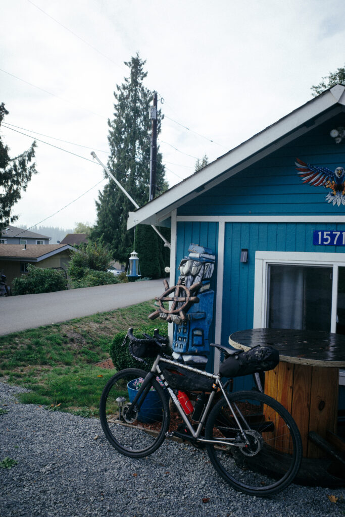
A friend and I went on a short overnighter at the beginning of January out to Salt Creek. A relatively short ride, about 44 miles each way, but just enough climbing to be fun. The night was wet even though the meteorologists promised us clear skies, and we awoke once to a massive branch falling not far from our campsite. We have set a goal of at least one overnight trip every month this year, and January and February are certain to be the most challenging with the weather and how much extra clothing has to be packed.
The middle of January has brought a brief bit of sunny but cold weather and it’s been irresistible to skip a bit of work to get out in it. I had a mild knee injury at the end of December that caused me to take a couple weeks off the bike to recover and I’ve been pushing myself pretty hard now that my knee feels better.
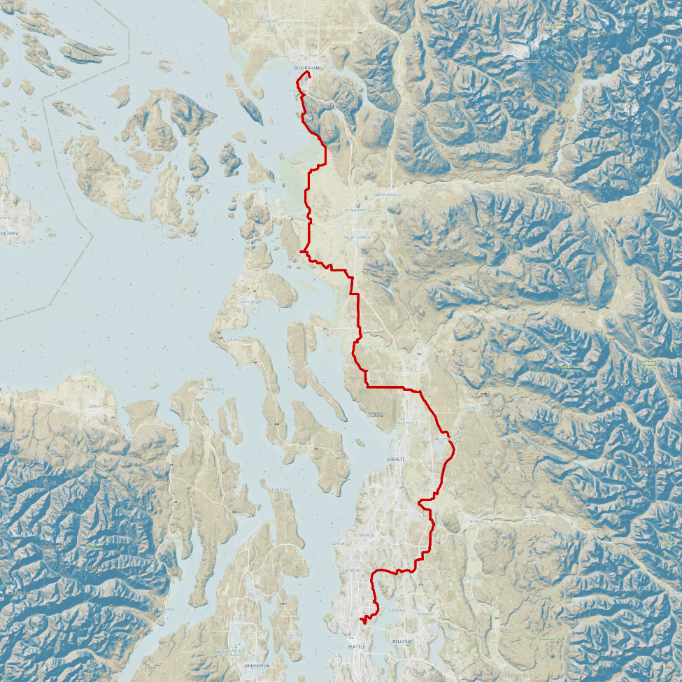
The first part of the ride was through downtown Bellingham from our hotel to the bayview trail on the waterfront. We stopped just before the boardwalk at a cafe for some coffee and a small breakfast. Our route tried to get us to follow the bayview trail after the boardwalk but due to a trail closure for construction we were rerouted onto some nicely shouldered surface streets. We reached Chuckanut drive and rode with traffic for a mile or so before reaching Bellingham’s Interurban trail.
The Interurban trail had a beautiful gravel surface and felt great with my 40mm tires. There were a few dips and hills where there had clearly been a bridge from when this trail was a rail line. We then merged onto Chuckanut drive for a bit of climbing and then a fast descent into Skagit valley. Edison was an adorable slow little town with an excellent bakery called Breadfarm, as well as the Terramar Brewstillery where we got a pizza and some pours of beer. We then entered the most enjoyable part of the ride, the segment between Edison was through the Skagit valley farmland on small low-traffic roads.
The Shore trail, just south of Bayview, was a very nice, grade separated trail with a compacted gravel surface suitable even for road bikes. It seemed that the trail was somewhat of a levee, with a water level on our right that was higher than the farmland to our left. We passed through Whitney and then reached La Conner where we stopped for a rest and a beer at La Conner brewing Co. We passed Stanwood without stopping and the got to experience not only the best road of the trip, but probably one of the top three roads I’ve ever ridden on; Miller road. A closed wooden ramp brought us down there from Pioneer highway and we emerged from the light tree cover into the farmland
After the beautiful section through the farms we had to take a short but slightly harrowing road to our AirBnb on lake Goodwin. Uphill with no shoulder and fairly constant traffic, not the best after a full day of riding.
The second day started with more non-existent shoulder riding as we made our way inland to the Centennial rail trail. We had initially planned to continue south from the lake and go through Everett but when we discovered the rail trail to our east we decided the detour to get there was worth the extra few miles. While the trail was very nice, the slog through the suburbs to get there and then back was probably worse than just taking the Interurban trail from Everett, but we got to do some exploring! We happened across someone’s art studio that was participating in the Snohomish studio tour, and stopped to see their art and they kindly offered us snacks and a water refill.
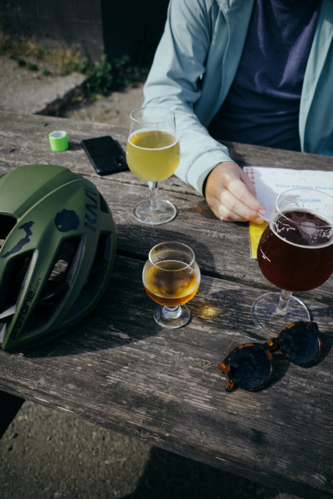
We finally made it to the mire that is the Burke-Gilman trail and locked in for the last few miles. The total distance was 130 miles over the two days with just over four thousand feet of cumulative climbing. Then it was time for recovery at Ladd & Lass brewing with tortas from the mexican food truck next door.
A great ride, and the section through the Skagit valley was the absolute highlight. Alternative routes to skip the suburban hellscape surrounding Seattle would be considered next time, perhaps a detour down Whidbey island or even across the Olympic Peninsula and down Kitsap to one of the ferries.
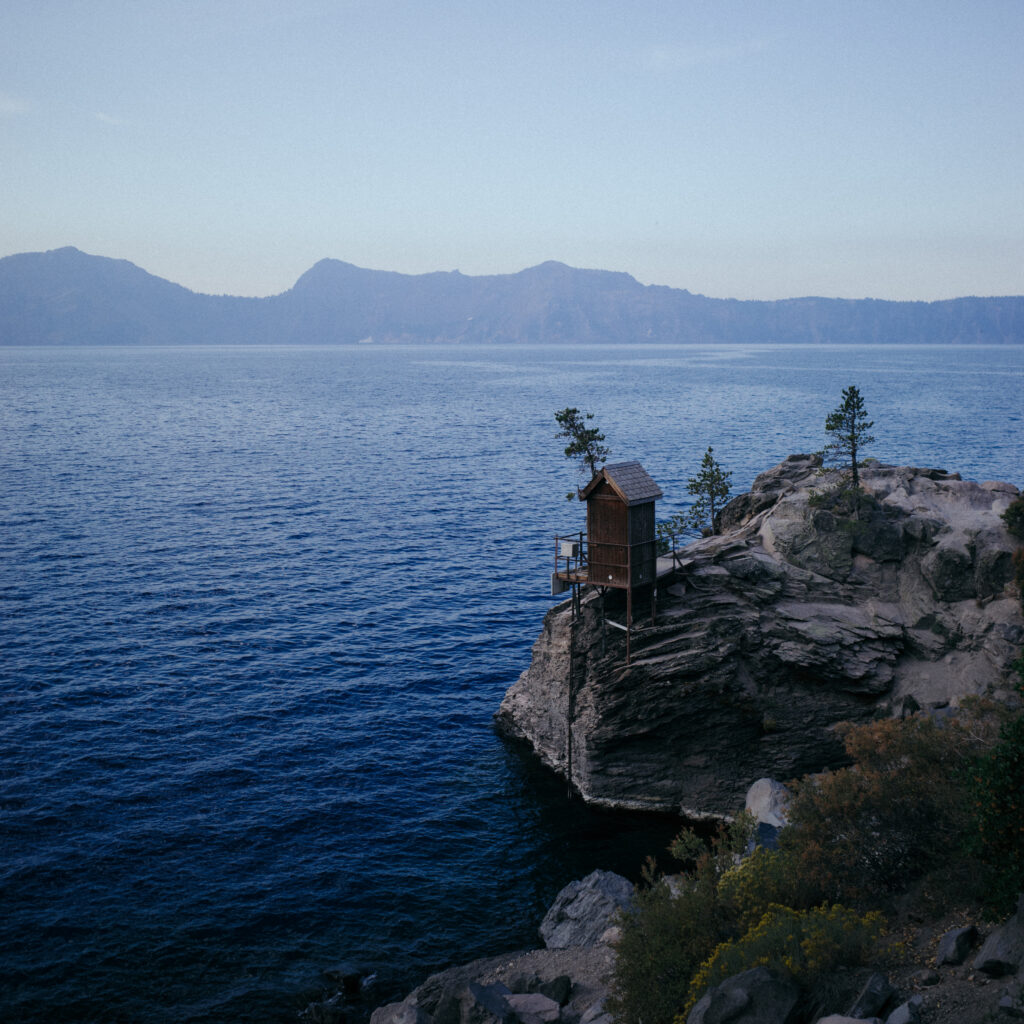
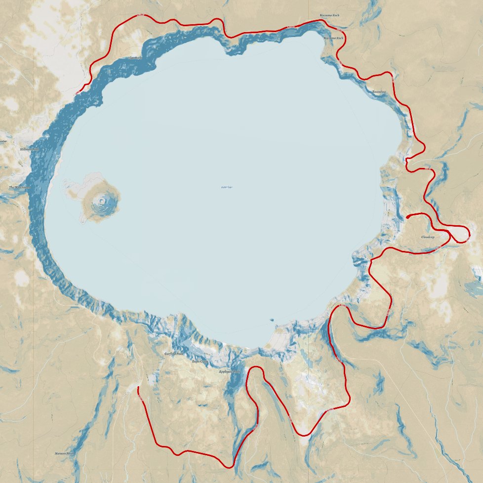
This was my first time attending the yearly Ride the Rim event around Crater Lake and it was just as beautiful as I had heard. I did the ride with 10 other people, most of whom drove down from Washington as well. We were staying at an airbnb about an hour and a half away from Crater Lake national park and we woke early the day of the ride to get there in time. We left our airbnb at 4:30am and got to the lake at 6:00, just in time to catch the sunrise across the lake. The weather was nice; mild temperatures and no wind, but unfortunately a lot of smoke in the air from nearby wildfires. It could have certainly been worse, but still, the odor of the smoke along with the high elevation of this ride would be giving our lungs a proper challenge.
We started on the northwest quadrant of the lake, the designated start point although we were starting about two hours earlier than the designated start time. The first part of the ride was in the early morning fog and after about an hour we found ourselves at the first rest stop. It was near this rest stop that there was the only trail with access to the lake, a short but intense 1 mile hike that brought us down about a thousand feet in elevation to the water.
The water was beautiful and many in our group took a short swim. The sun was getting quite high at this point so we all applied our sunscreen or got out our protection clothing. We next had a few ups and downs on the ride before the “big” climb; a bit over a thousand feet over 5 miles. The climb went by quicker than I thought it would, even with a short detour to the Cloudcap lookout. The descent was fast and fun with my max speed topping out at 42mph.
The final part of the ride involved waiting about 2 hours for the transportation logistics to resolve themselves; I waited at the finish point bike corral while a few other members of our group took the long and slow shuttle bus back to where we had parked that morning before driving back to load up our bikes.
Overall an incredible ride and experience but with frustratingly tedious logistics. I would certainly do this again at some point but probably not year after year.
7/10
Water & Lava
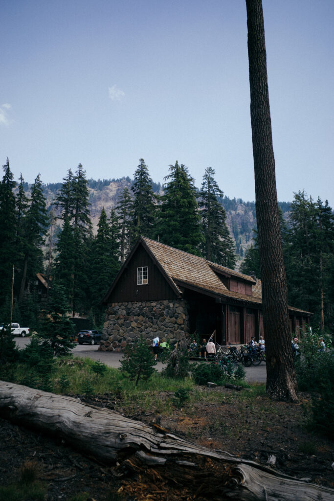
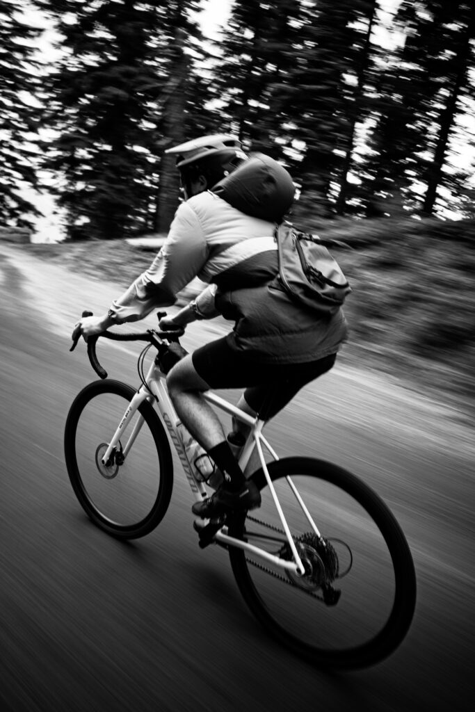
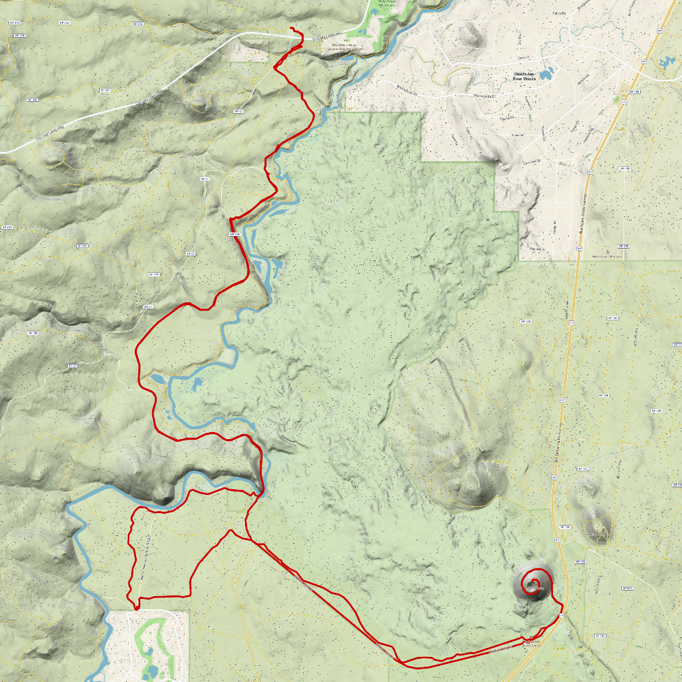
I found out about this route while looking up gravel rides near Bend on the fabulous website Dirty Freehub. They have many rides that all look like great adventures in their own way, but this is the one that I settled on. It was about the length I wanted since I was doing it on the same day I was driving back to Washington, and it was relatively flat which I wanted after all the climbing at Crater Lake.
The route started at the Cascade Lakes welcome center about a 15 minute drive southwest of Bend, I immediately departed the pavement of the parking lot and was riding on a dirt trail weaving around sparse trees. The trail snaked through the forest and past a few more unpaved parking spaces as it took me to and from the river. I then passed Benham falls, the largest waterfall of the Upper Deschutes river. I crossed the river on a narrow bridge and the trees soon thinned as Lava Butte approached.
I later learned that this area, including Lava Butte, was used by NASA to train astronauts to traverse rocky terrain in spacesuits before the first moon landing in the ’60s. The Butte and surrounding area was thought to very closely resemble the surface of the moon. Their practice in Oregon caused the realization of some improvements to the spacesuits, such as a larger faceplate to see the ground better, as well as sturdier gloves and more flexible ankles.
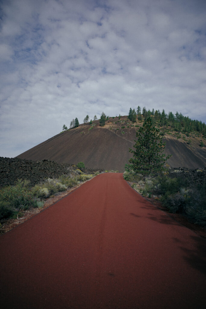
The climb to the top of the cinder cone was short but very enjoyable due to the beautifully paved, bright red road. This whole ride had some of the most perfect surfaces one could wish to ride on; carved dusty single track, hard-packed gravel roads, and pristine cycle paths.
This was without question one of the most enjoyable rides I think I’ve ever done. Absolutely worth a small detour and arguably worth the trip from Washington to Bend on its own.
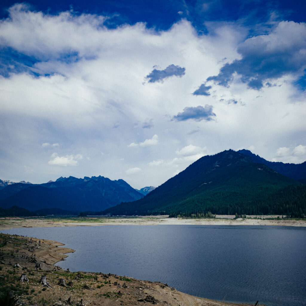
Seattle to Ellensburg. 120 miles of what I thought was to be nice hardpack away from traffic and surrounded by trees and nature. On paper this route looked dreamy, a slight 1% climb up 3000ft to the Snoqualmie tunnel and then a gentle 0.5% descent down the other side. The plan for this route was to make it all the way to Yakima but I ran out of daylight due to the conditions along the way.
The ride started at 4:45am and the morning was foggy and peaceful. The start of the ride crossing the 520 bridge and the Issaquah-Preston trail was absolutely lovely. Shortly after Preston I was deceived by my routing software to tackle a very steep climb on some dreadful singletrack. Eventually, after a bit of hike-a-biking, I emerged from the woods into a small neighborhood and continued to ride through a golf course with paths that I certainly was not supposed to ride on.
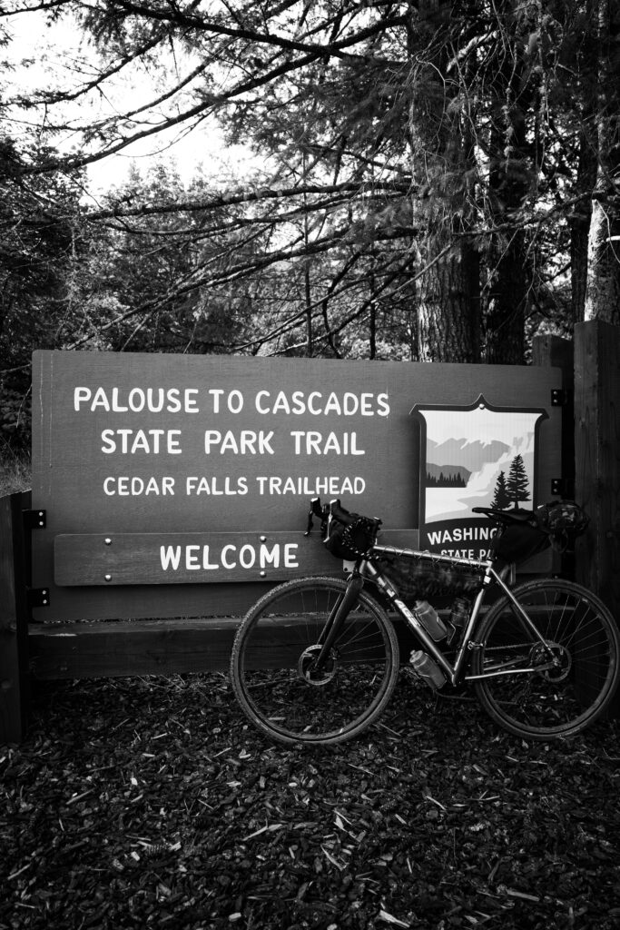
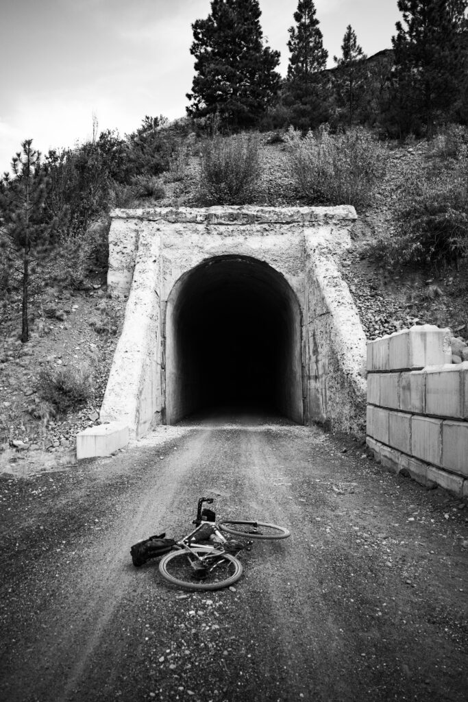
After a short stint on the Snoqualmie valley trail I reached Rattlesnake lake and the start of the Palouse to Cascades state park trail. The ascent from here was slow but gentle and after crossing many trestle bridges I reached the Snoqualmie tunnel. The cold wind from the east was noticeable before the tunnel was even in view. It was around 85 °F that day but cooled off rapidly as the tunnel approached.
I took a brief stop before entering to put on a wool buff and wind shell. The exit was visible as soon as my eyes had adjusted despite being over 2 miles away. The temperature dropped down to about 50 °F halfway through. I’m not sure how fast I went through the tunnel as I lost GPS connection, but I’d estimate a steady pace of 16-18mph with the occasional slowdown to avoid one of the freshly made puddles filling via drips from the ceiling.
Here, 80 miles in, began the slog of this route. What I thought would be an easy descent turning into the opposite as the trail had been covered in a fresh layer of far too chunky gravel that had yet to settle or have lines carved into it by service vehicles. Every mile or so was a metal gate most of which had to be dismounted to get around, or arrive at a complete stop to unchain, open, and then re-chain behind. This section felt very long due to the gravel and gates but eventually Cle Elum was reached and shortly after Thorp. In Thorp I abandoned the Iron Horse trail to enjoy some of the paved roads that run adjacent to the trail and highway. They were very comfortable after the last 40 miles of gravel and it was nice to feel my speed get up to 18mph instead of the average of 11mph I was doing before. I decided to call the end of the ride in Ellensburg rather than do the 40 mile poorly shouldered highway section through the canyon to Yakima due to the sun already being low to the horizon; my route planning did not anticipate being slowed so much by the conditions of the trail.
I was definitely underbiked for this with my 35mm tires and suffered for it. Still, the views and variations as you travel through different regions makes it so interesting, and the feeling of having crossed one of the largest mountain ranges on the continent is a satisfying one.
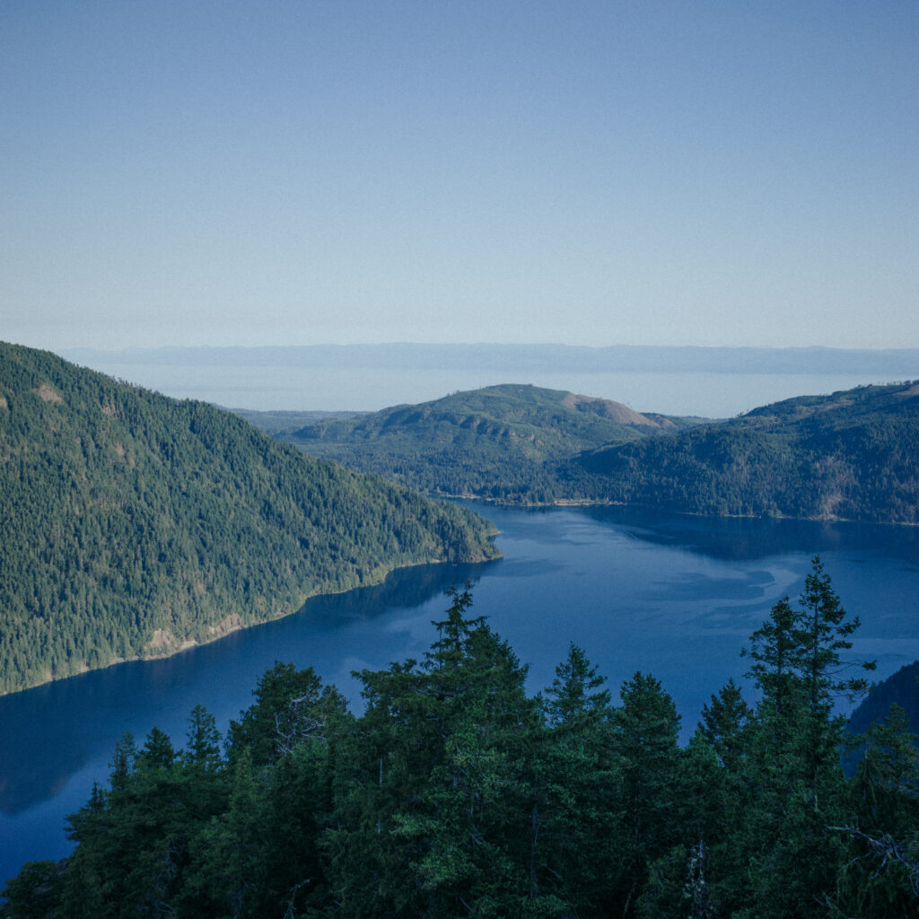
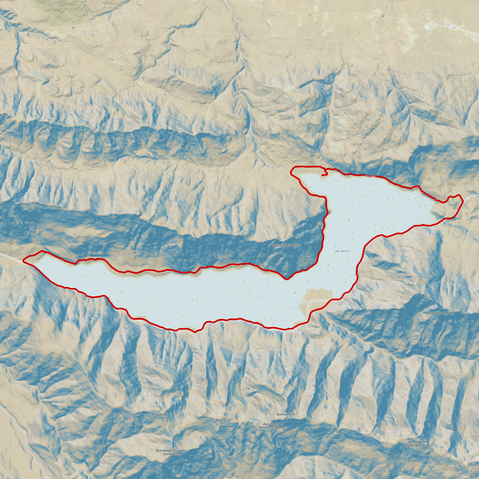
A continuation of the circumnavigation of bodies of water disconnected from the sea. This route was challenging since, although the northern path along the lake is a beautiful rail trail, the southern part is a highway. Much of the strategy of this loop was optimising to have the safest ride along the highway as possible. The starting location was Piedmont, as I was camping at the Log Cabin campsite the night before. This allowed a very early start to the ride as there would be no driving or bussing to start the day. The loop was clockwise to be sure to be on the lake side of the highway which has slightly larger shoulders and frequent viewpoints to duck into when a logging truck was passing.
The ride started at 6:00 in the morning, as early as possible while having some light to ride in. East beach road was beautiful in the morning sun and not a car was seen for the first 20 minutes of the ride. Eventually the highway was reached and a lavish 8 foot shoulder awaited me but not for long. Eventually as the highway met the lake the shoulder reduced down to less than a foot which made riding in the lane unavoidable.
The ride along the southern edge of the lake was stressful but made better by the views of the sunrise colours kissing the lake. Eventually the road curved north and a short stretch of gravel connected me to the Spruce Railroad Trail.
The rail-trail was the most enjoyable part of the ride by far, dead flat with not a person to be seen. Stunning views of the lake were to my right and the dense forest to my left. I soon reached the 450 foot long tunnel that signaled the approach of the east side of the lake and I was within a mile of my starting place.
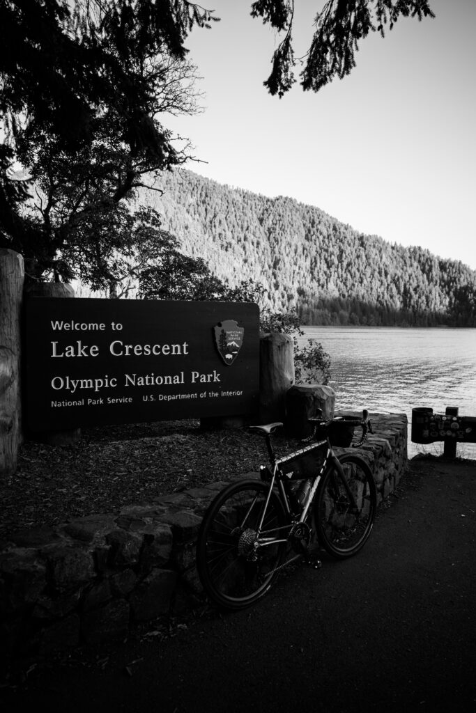
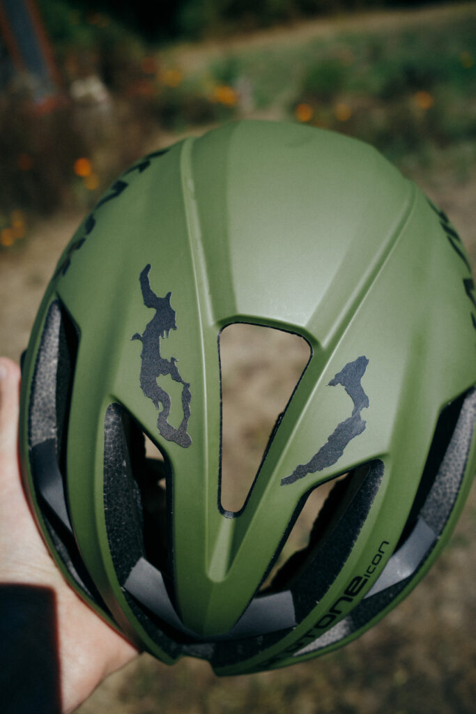
The lake Washington and lake Crescent stickers applied to my helmet.
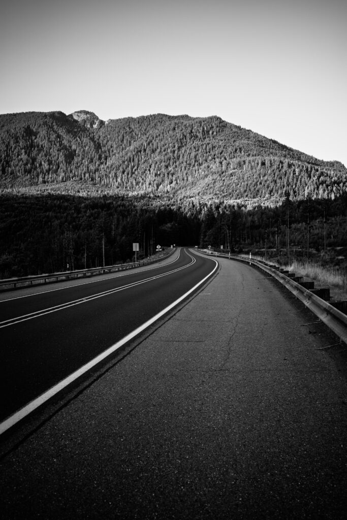
A very lovely ride but only one to do early in the morning when traffic is at its least busiest. The next morning we hiked Storm King which was a very difficult hike but with very beautiful views and good for the leg muscles.
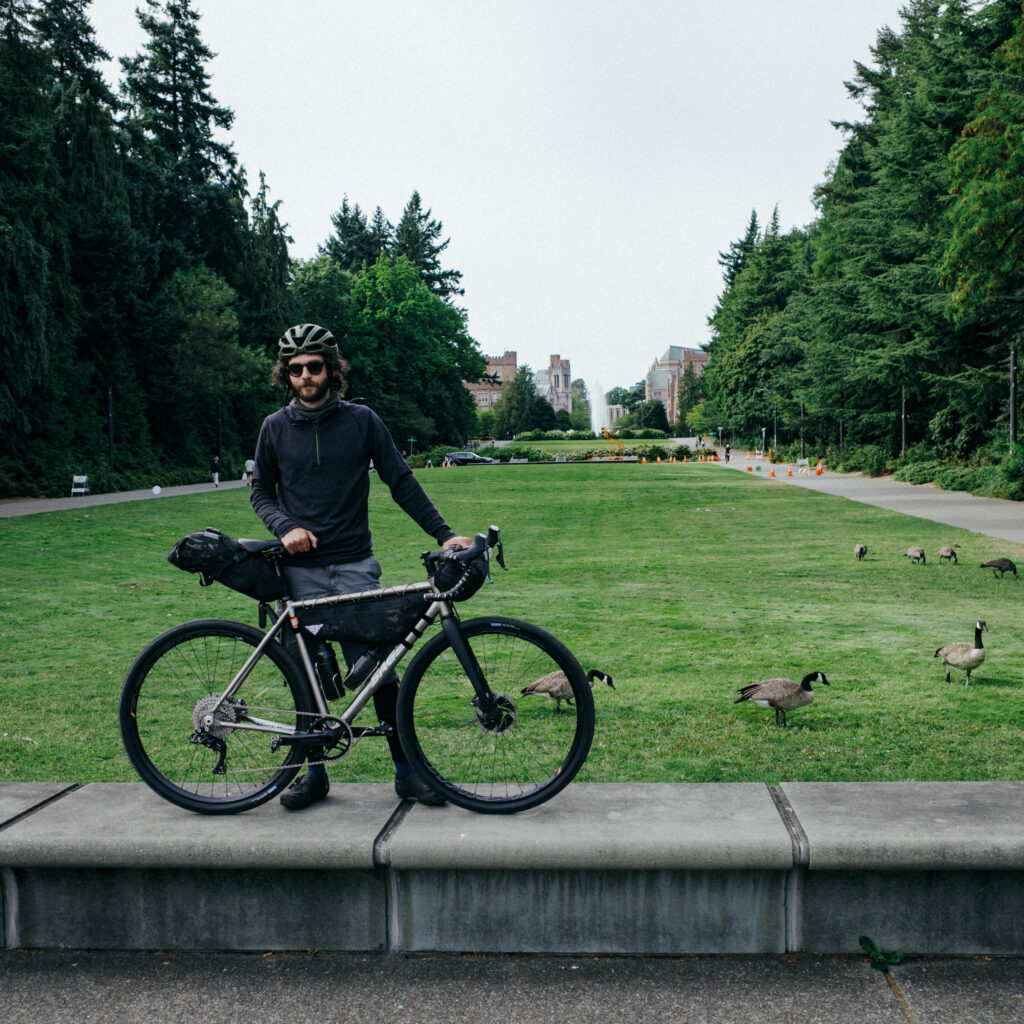
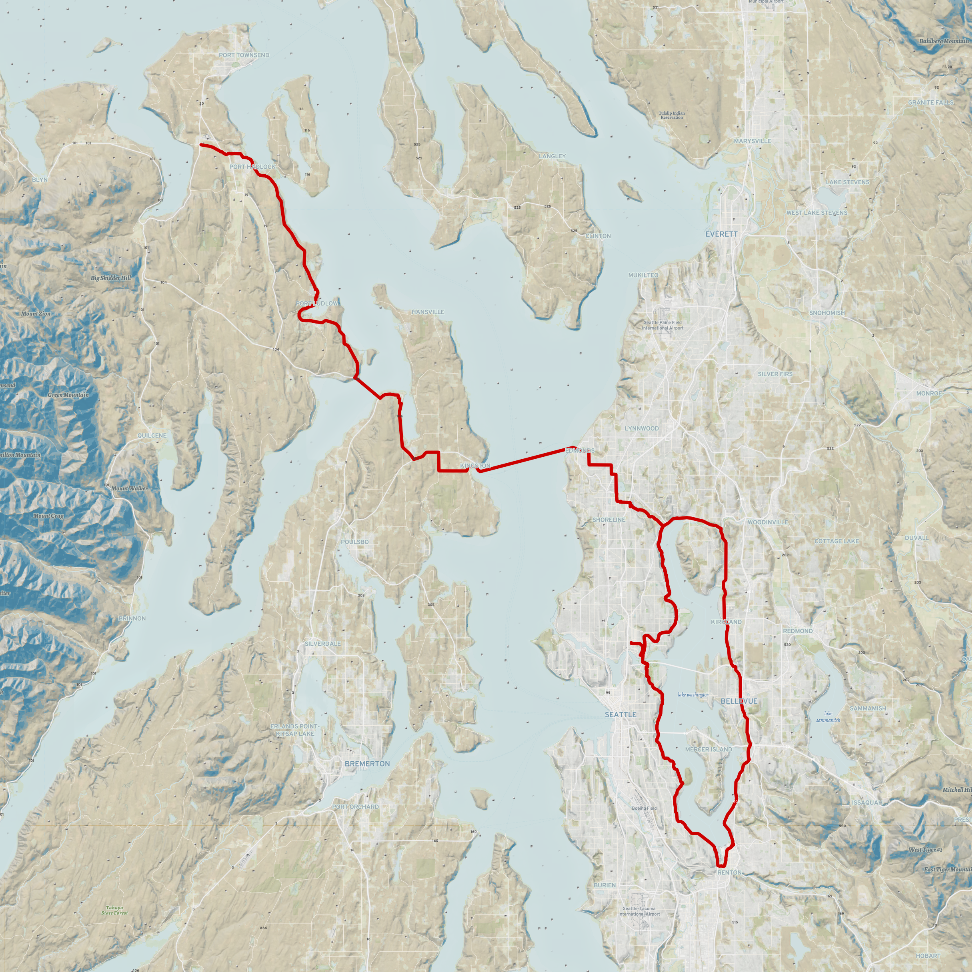
The idea for this route came from my friend who, in our scheming to make some retro-reflective stickers for our helmets, came up with the idea to shape them like bodies of water in our state. The first two he made were Lake Crescent and Lake Washington. I realised that the only way to properly add the stickers to my helmet was if I first fully circumnavigated each of the lakes before applying them. I was Seattle bound that weekend anyway, so I had the idea to combine this lake loop with completing a 100 mile ride, a milestone I had been working up to.
The starting location was chosen to be the Four Corners park and ride near Port Townsend. An easy bus ride away and precisely positioned to get the required distance in. I set off from home to the transit station at 6:30am to catch the 7:00 bus and arrived to Four Corners at 7:40. The first 15 minutes of the adventure was spend torching my brake pads in the parking lot to hopefully fix a squeaky front brake, fortunately it did work else I would have been making a prompt detour to a bike shop. The ride down the east side of the Olympic Peninsula and across Kitsap was beautiful. Perfect low traffic roads and undulating hills. The idea of crossing the Hood Canal bridge had seemed daunting but felt very safe and seeing the glassy surface on one side and choppy water on the other made for a very enjoyable crossing and I was boarding the Kingston ferry before I knew it.
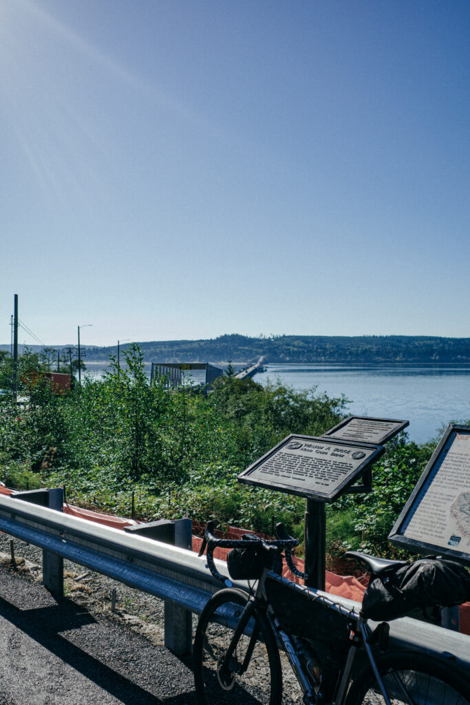
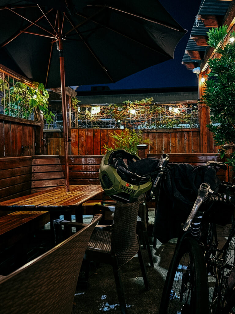
The ride from Edmonds to Kenmore was tolerable, a few inattentive drivers and very steep hills, but once I started heading south on the Burke-Gilman trail that was all forgotten. Much of the ride down from here was forgettable, with the only excitement coming from interactions with other cyclists. The route was very easy to navigate with a sign every half mile or so saying “Lake Washington Loop”. My first short rest was at the southernmost point of the ride, on Airport way in Renton. A brief lie down under a shady tree looking across at Boeing jets being assembled. The ride up the east side of the lake was not as nice as the west side, with lots of shoulder riding and breathing in of car emissions. Eventually the Burke was reached again in Kenmore and the loop was technically complete. I had just a small bit of riding back to U-district in order to eat a large amount of pizza and spend the night. My friend met me just north of Magnuson park with a glorious Mexican Fanta which was the highlight of the day.
The next afternoon my friend and I went on a short recovery ride, across the 520 floating bridge and then back east on the I-90 bridge. This ride was celebrated with Bitburgers and chicken tenders to make up for the calorie deficit from yesterday. I feel good about the 100 mile ride, it was tough but not crippling and it makes me optimistic about a 160 mile ride I am planning towards the end of this month.
I can only recommend this ride to someone if they are doing it for the fact of circumnavigating the lake, as the riding was not particularly enjoyable.
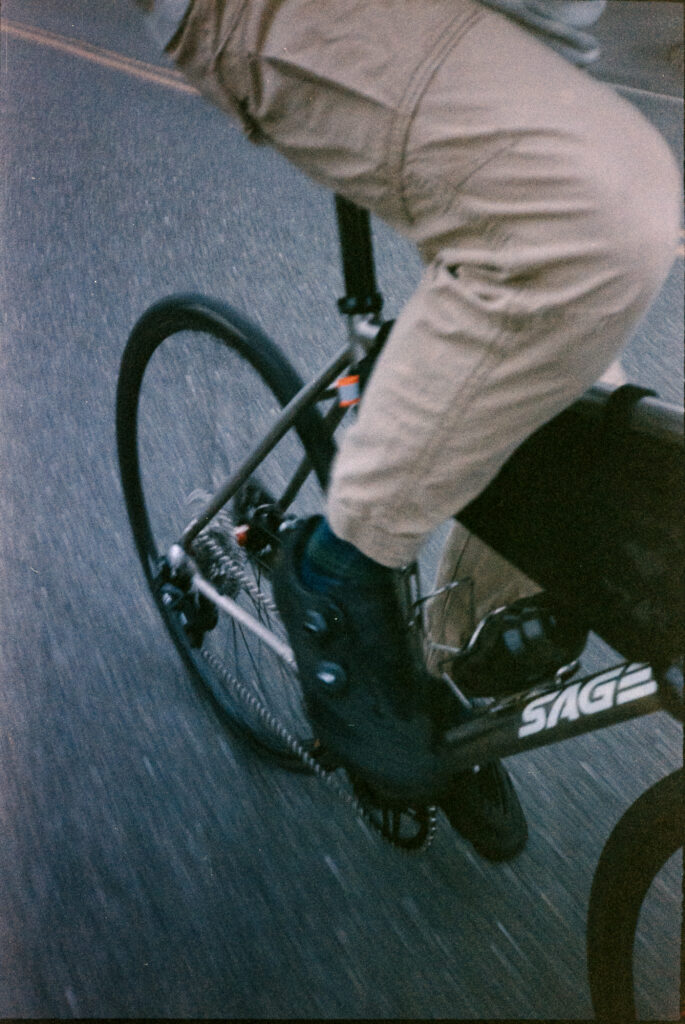
One of the nicer motion picture film stocks I’ve tried. Very beautiful colors and a coolness that tones down the heat of summer without feeling cold. Next time I will probably over expose this film by at least 2/3 of a stop, even in direct sunlight.
Taking the fixie to Vashon island was a fun trip. Nice exercise in multi-modal transit; ride to bus, bus to ferry, ferry to island.